The Right Track for Climate-resilient Road Infrastructure - SAR-CLIMATE

The Right Track for Climate-resilient Road Infrastructure

0 0
Read Time:7 Minute, 33 Second

What is the cost of climate change to South Asia’s transport sector?

How is the concept of resilience applied to transport infrastructure?

Today, infrastructure systems are highly inter-connected and their resilience relates to their core characteristics such as agility, changeability, and adaptability.

With over 50 definitions for infrastructure resilience, it means different things to different stakeholders. Without a suitable definition, road agency decision-makers may be reluctant to explore resilience- building efforts.

A 2014 study shows how the resilience concept has been linked to indicators of road performance such as mobility, travel time, and physical conditions. When a hazard strikes, it is not certain that performance will drop significantly or recover quickly depending on the robustness, strength, and physical conditions of the road.

Ideally, we want to be able to reach a point of pre-event or better performance after the hazard and this depends both on our abilities and the road’s ability to recover. Nevertheless, we are often not able to immediately see the full spectrum of the system failure during sudden onset hazards (i.e., flash floods) or slow-onset hazards (i.e., rising temperatures), as roads may exhibit deterioration like stripping or rutting sometime later.

Transport resilience also can be approached based on ex-ante state, referring to the capacity to absorb shocks while maintaining the function, and ex-post behavior, projecting the ability to return to a new stable operational condition after a given shock.

Therefore, the concept of resilience infrastructure can be perceived as a degree of the processing of a set of capabilities that indicate both properties and behavior of the system. Either we are talking about the ex-ante or static properties of the system – where we are describing the current condition of the asset that we are interested in as well as the state of the system and how it can withstand the hazards.

Or we can also talk about the ex-post dynamic behavior of the system, what it does after the event, and how it is expected to respond during and after the shock.

How do we start analyzing road resilience?

Without proper scoping and limiting the boundaries of the problem, we won’t have a chance to understand it fully, let alone solve it. The infrastructure resilience scope analysis consists of dimension, temporality, hazard system, life cycle, spatial scale, system level, level of effort, and an intervention phase.

After identifying the scope, we move on to properties the first is redundancy or buffer capacity which focuses on how if one component fails, another component compensates. During a flash flood, for example, we can either think of providing additional culverts for the flood or think of an alternative route.

The second property is rapidity or quick recovery – we can employ traffic management systems to ensure mobility or pre-event planning for rapid restoration. The third property is resourcefulness, focusing on navigating resources and interventions in response to shock or preparedness before adverse events.

The fourth and last property is robustness which explores structural strength and reliability and how the road is still performing although the shock is there. For example, polymer-modified bitumen (PMB) can protect against extreme heat or anti-corrosion materials in maritime environments and maintenance plans.

These properties allow us to disaggregate an abstract concept like resilience to break it into smaller parts so we can analyze it better. They’re also important since they assist with navigating and defining proper attributes. Selecting properties is our primary target of the scoping and is a very important step toward assessing resilience.

For example, extreme precipitation can have significant impacts on roads with regard to the road’s structure and surface. Water can get trapped between the base and sub-base causing swelling and shrinking of soils, or reducing the adhesion bond between the aggregate and the binder which in turn can lead to surface cracks and stripping. Therefore, we can use the properties to arrive at the attributes which will help us in our evaluation of road resilience.

According to a 2019 study, flooding accounts for over US$ 9.6 billion of direct disaster damages to the world’s roads and railways every year, where South Asia’s level of exposure to such hazard impacts is very critical.
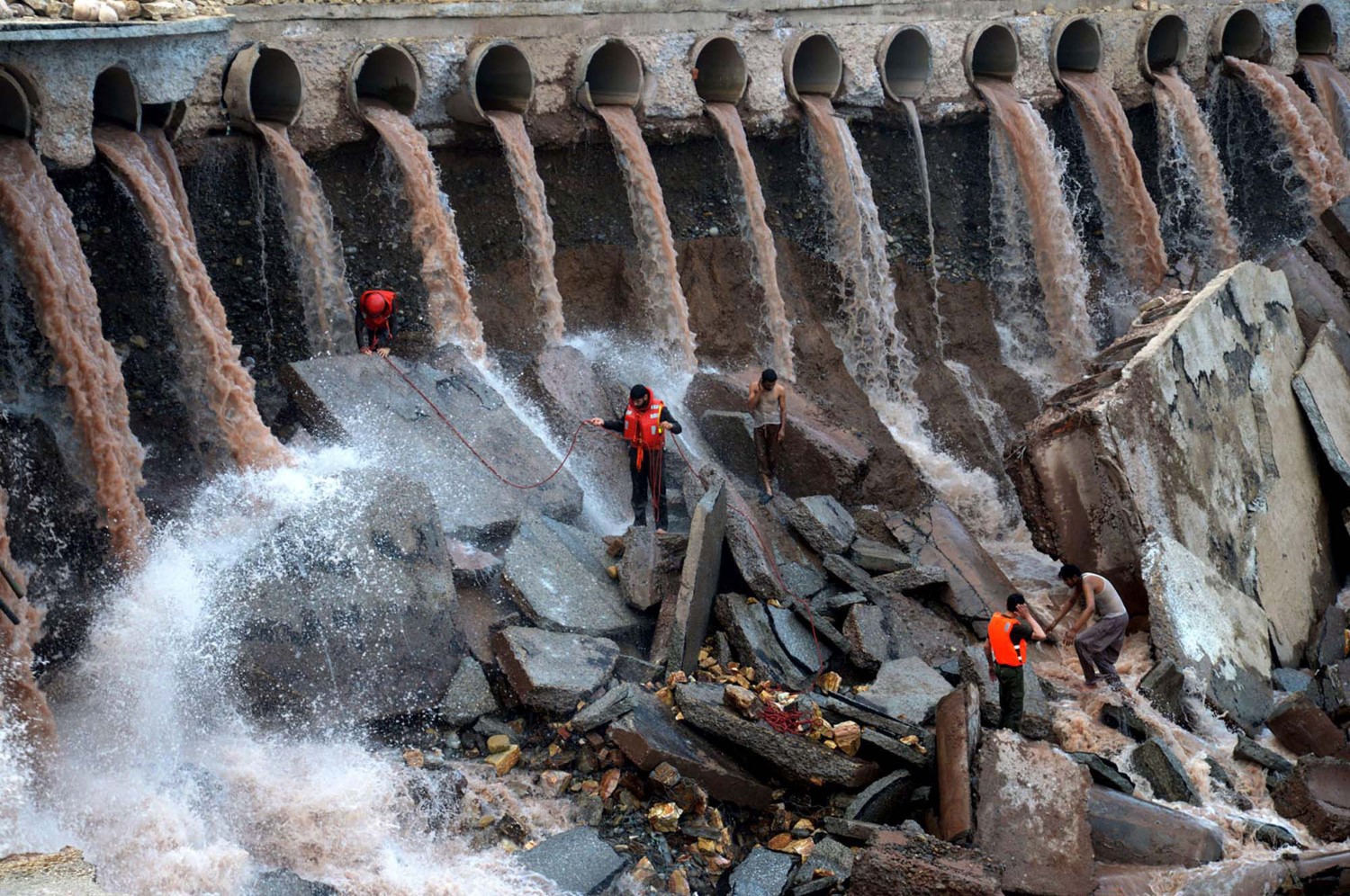
Rescuers measuring the extent of damages at Bara Bridge in Peshawar, Pakistan (Photo by: Asianet Pakistan/Shutterstock.com)

What solutions can be implemented in South Asia?

First of all, drainage systems are very important for South Asia’s roads based on current climate conditions. The structural capacity of a pavement with a well-functioning drainage system recovers considerably fasters after rainfall. It could take up to three years for a road’s subgrade to drain out the impact of saturation after flooding and it can lose up to 60 percent of its load-bearing capacity if it has been fully soaked.

Authorities have a ‘window’ to build road resilience in the planning, design, construction, and operation phases. For example, some pavements can have a design that allows the water to flow down into a sub-surface drainage system or adopt a different strategy with a lower air void design to stop water from infiltrating altogether.

Authorities should integrate exposure and hazard risk assessments into their planning phase so that they are aware of what is happening and what will happen to roads. Next, they need to enhance and change the design input based on exposure and vulnerability, specifically the input of hydrologic models based on the future impacts of climate-induced floods.

Climate information, especially precipitation and temperature and their changes, should be a leading factor in the design process. I normally observe in South Asia that authorities consider the California Bearing Ratio (CBR) and axle loading, which are of course important, but they are not the only hazards. This climate information should also be up to date to be a reliable source of information.

Road agencies are facing a variety of constraints, for example, if they want to control the groundwater table, agricultural authorities may want to increase water supply and flow in a specific area. There has to be some liaising between different authorities to integrate water resources management which also protects road infrastructures in the region.

What are common issues for road standards in South Asia?

The writer is Regional Transport Specialist, ADPC, and can be reached at: milad.zamanifar@adpc.net

Happy
Happy
0 %
Sad
Sad
0 %
Excited
Excited
0 %
Sleepy
Sleepy
0 %
Angry
Angry
0 %
Surprise
Surprise
0 %

Average Rating

5 Star
0%
4 Star
0%
3 Star
0%
2 Star
0%
1 Star
0%