
Read Time:4 Minute, 51 Second
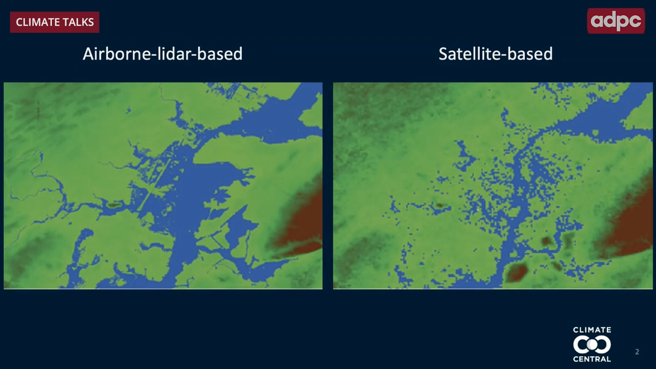 A comparison of airborne-lidar and satellite-based observations in the same area (Photo by Climate Central)
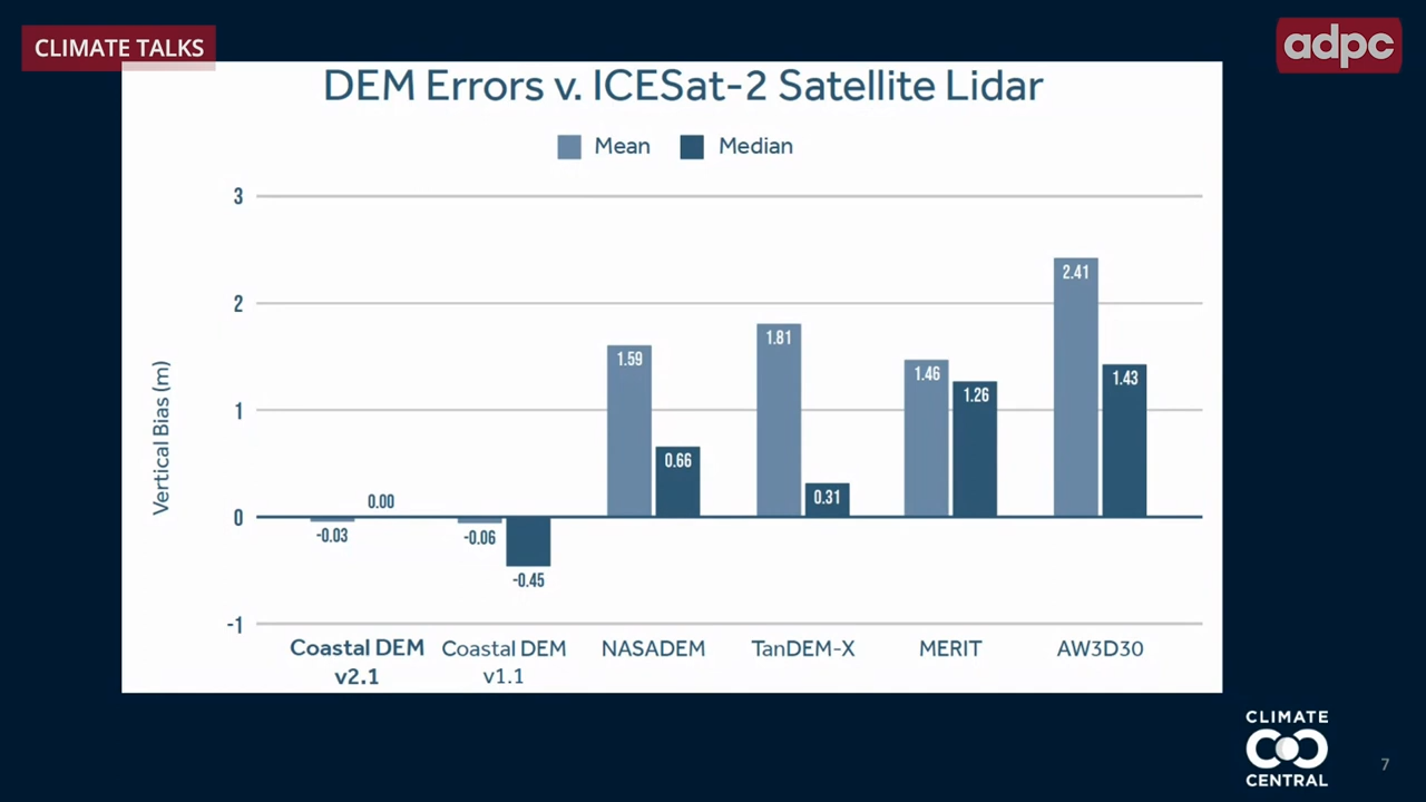 A comparison of vertical bias Digital Elevation Monitoring (DEM) and Ice, Cloud and land Elevation Satellite (ICESat-2) Satellite Lidar in meters (Graphic by Climate Central).
It turns out that we don’t know a lot about the elevation of the land in many parts of the world!
Dr. Benjamin Strauss spoke with ADPC during its Climate Talks panel discussion on sea-level rise.
Happy
0 %
Sad
0 %
Excited
0 %
Sleepy
0 %
Angry
0 %
Surprise
0 %